


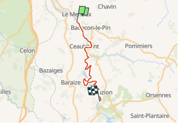
Sob 17 le menoux cuzion

Glurps
User

Length
16.6 km

Max alt
224 m

Uphill gradient
351 m
Km-Effort
21 km

Min alt
113 m

Downhill gradient
319 m
Boucle
No
Creation date :
2024-09-30 07:34:14.0
Updated on :
2024-09-30 17:05:39.95

FREE GPS app for hiking
 SityTrail
IGN / Geographical institutes
SityTrail Plus
The world is yours!
About
Trail of 16.6 km to be discovered at Centre-Loire Valley, Indre, Le Menoux. This trail is proposed by Glurps.
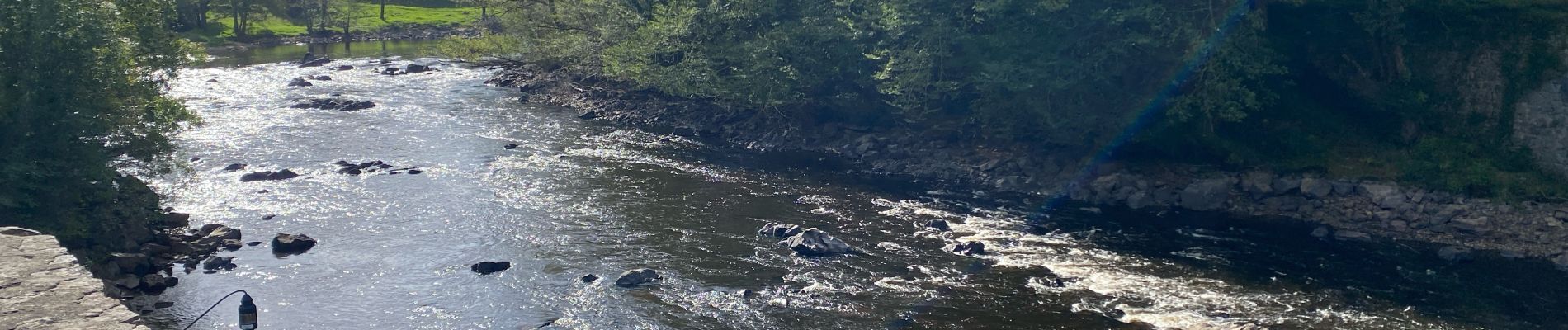
Photos


Positioning
Country:
France
Region :
Centre-Loire Valley
Department/Province :
Indre
Municipality :
Le Menoux
Location:
Unknown
Start:(Dec)
Start:(UTM)
390364 ; 5155835 (31T) N.
Comments